vtiles-example
README
Minimal implementation of a javascript client for OGC API - tiles, using leaflet.js. The client is reading two vector tile layers from the eMOTIONAL Cities catalogue, published using pygeoapi with a elasticsearch provider.
Metadata elements such as title and bounding box are read from the tileset metadata (see code sample bellow).
 (async () => {

        // collection metadata
        const metadata_cardio = await fetch(getCollection(pbfURL_cardio)).then(response => response.json());
        const metadata_pm10 = await fetch(getCollection(pbfURL_pm10)).then(response => response.json());

      // Retrieve title
        var overlayMaps = {
        [metadata_cardio.title]: mapPbfLayer_cardio,
        [metadata_pm10.title]: mapPbfLayer_pm10
        };

        // Retrieve bounding box
        const x = (metadata_cardio.extent.spatial.bbox[0][0] + metadata_cardio.extent.spatial.bbox[0][2])/ 2.0;
        const y = (metadata_cardio.extent.spatial.bbox[0][1] + metadata_cardio.extent.spatial.bbox[0][3])/ 2.0;

        map.flyTo({ lng: x, lat: y });

        var baseMaps = {
            "OpenStreetMap": OpenStreetMap_Mapnik,
            "Esri World Gray Canvas": World_Light_Gray_Base
        };

        var layerControl = L.control.layers(baseMaps, overlayMaps).addTo(map);

        let timeTaken = Date.now() - start;
        console.log("Total time taken : " + timeTaken + " milliseconds"); //20 milliseconds - 0.29%

    })();
There is also code for loading feature layers and benchmarking the application start using either tiles or features. You can read more about this experiment on doublebyte.net.
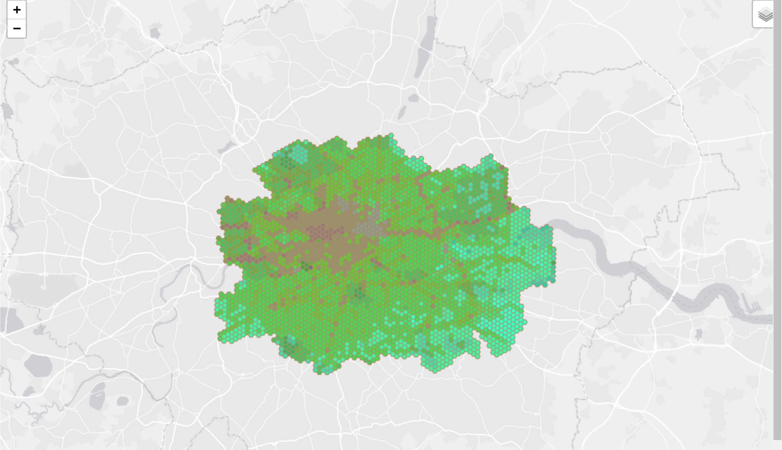
Check this live at: https://emotional-cities.github.io/vtiles-example/demo-oat.htm
License
This project is released under an MIT License
![]()